


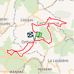
Ortholes et environs

jerome1246
User

Length
22 km

Max alt
643 m

Uphill gradient
376 m
Km-Effort
27 km

Min alt
527 m

Downhill gradient
376 m
Boucle
Yes
Creation date :
2015-11-05 00:00:00.0
Updated on :
2015-11-05 00:00:00.0
1h48
Difficulty : Medium

FREE GPS app for hiking
 SityTrail
IGN / Geographical institutes
SityTrail Plus
The world is yours!
About
Trail Mountain bike of 22 km to be discovered at Occitania, Aveyron, La Loubière. This trail is proposed by jerome1246.
Positioning
Country:
France
Region :
Occitania
Department/Province :
Aveyron
Municipality :
La Loubière
Location:
Unknown
Start:(Dec)
Start:(UTM)
471307 ; 4915014 (31T) N.
Comments